Geology
Advertisement
Coltop3D Beta v.1 6
Coltop3D is a full featured LIDAR data processing and analyzing software for geologists. It is designed for the interactive analysis of orientation of airborne and terrestrial LiDAR data and digital elevation models (DEM) at local and regional scale.
Advertisement
Geosoft Target v.7. 2. 2001
Geosoft's Target™ is essential geology software that simplifies the processing and visualization of subsurface drillhole and borehole data, enabling explorationists to better manage drill projects, from initial planning to the evaluation stage.

NAL SAROVAR v.1.0.0.0
This app is about a very famous and wonderful place 'Nal Sarovar Bird Sanctuary',Ahmedabad,Gujrat,India. It contains all the required information for one who wants to go there, from the map to the places, information about all birds, its geology and
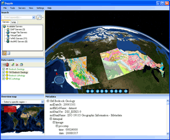
Dapple v.2.1.4
Dapple is a global data explorer designed to provide an open and optimal environment for visualizing, presenting and sharing massive quantities of geoscientific data on desktop computers.
FreeView v.10 3
Geomatica FreeView is a flexible data viewing tool supporting over 100 raster and vector formats for loading, viewing, selection, and enhancement. FreeView is useful for any geospatial data viewing application, and is freely distributable.
SciViews-R v.0.9.0.2
SciViews-R is a series of packages providing a GUI API on top of R, a free (Open Source) statistical software based on the S language. SciViews is one of the first GUI for R and it is developed since 2001.
Geomatica FreeView v.9. 1. 2005
Geomatica FreeView is a flexible data viewing tool supporting over 100 raster and vector formats for loading, viewing, selection, and enhancement. FreeView is useful for any geospatial data viewing application, and is freely distributable.
WinFence v.2 21
WinFence can be used to graphically create detailed, full-color, cross-sections and fence diagrams quickly and easily. The program can be used to interpret and map soil and rock layers, contamination, fossils, minerals and hydrocarbons.
The KINGDOM Suite v.7 5
Making better decisions with minimal risk starts with having a clear vision of the prospect.
VIEWLOG v.3.0.0059
VIEWLOG provides a truly integrated borehole data management and interpretation system.
Encom PA Viewer v.11.0
Encom PA provides advanced interactive visualisation in one-, two-, and three-dimensions with support for most geophysical and geological information types used by companies to cover regional exploration through to mine development.